Using Maps
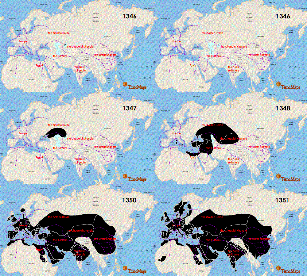
Maps can provide important evidence for research into healthcare history and can also prove useful for the presentation of historical information. For example , they might be used to plot the progress of an epidemic in time:

ShareAlike 3.0 Unported (CC BY-SA 3.0)
or the relative positions of facilities in a healthcare establishment: :

Maps should not be used in isolation for research. Additional documentation may be required to confirm the accuracy, purpose, method of production, uniqueness, and detail of a map.
see Using Maps as Historical Sources from the National Library of Scotland.
Most Local studies archives and libraries hold maps of their local area for different periods.
Layers of London A map-based history website developed by the Institute of Historical Research. Users can access free historic maps of London and contribute stories, memories and histories to create a social history resource about their area.

